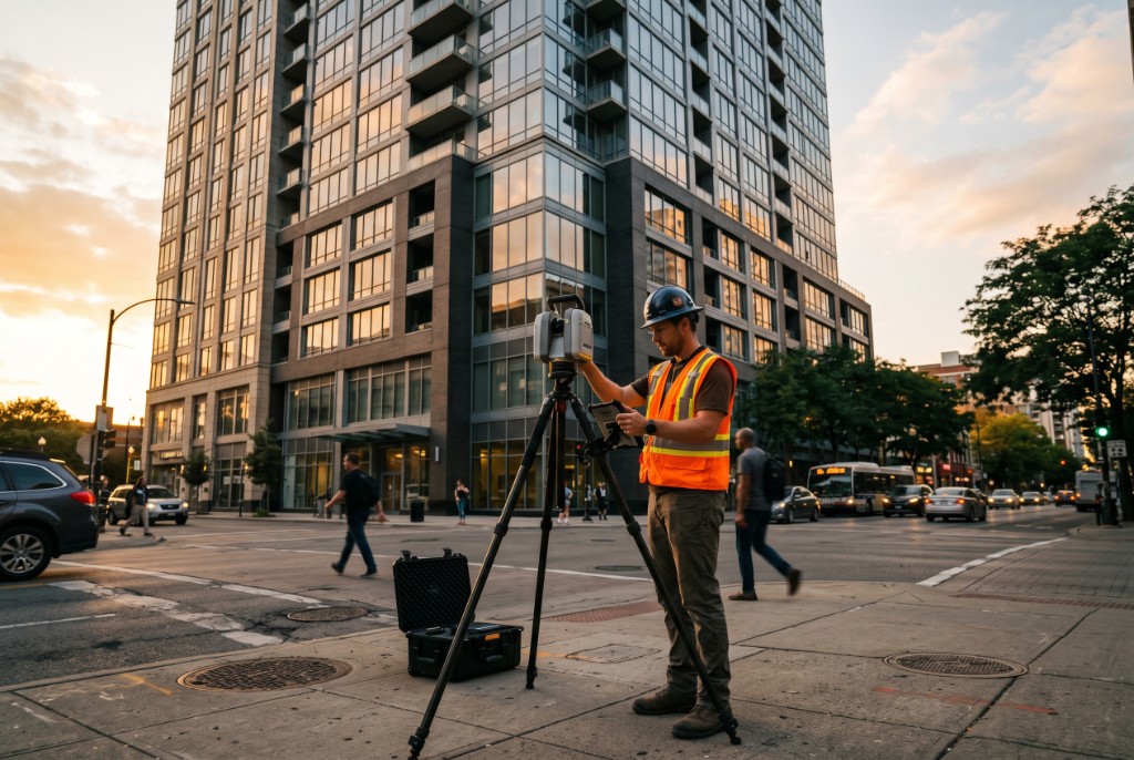
What is 3D laser scanning for construction?
Black Forge Technology provides 3D laser scanning for buildings and construction sites, plus Scan-to-BIM, across the continental United States. We capture as-built conditions with high accuracy for verification, modeling, and quality control (including concrete flatness FF/FL)—mobilizing nationwide for commercial, institutional, and infrastructure work.
Who is it for?
Contractors, owners, engineers, and facilities teams who need as-built documentation, Scan-to-BIM deliverables, concrete flatness verification, or accurate site data for design and construction.
3D laser scanning for buildings
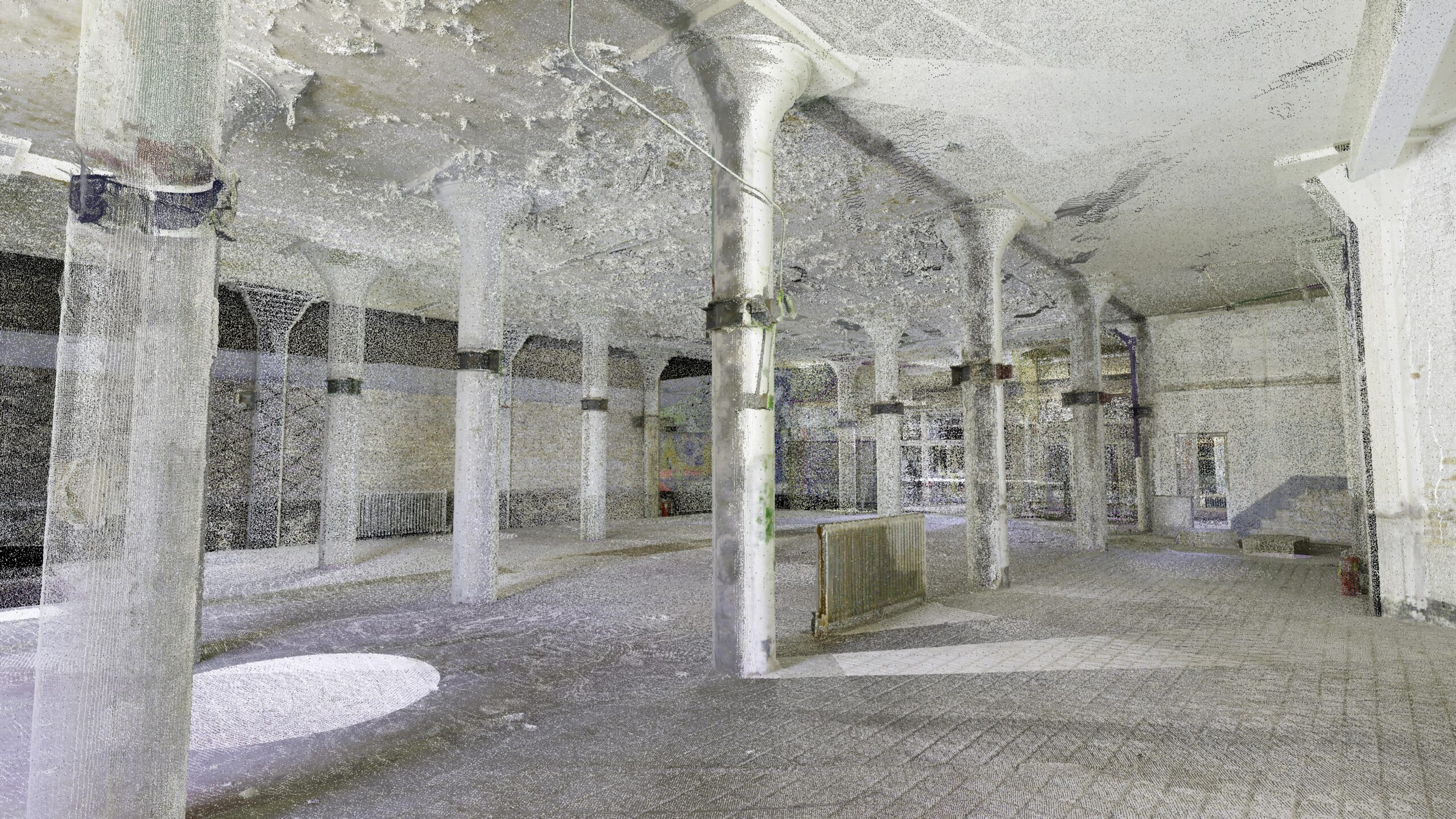
Laser scanning for buildings documents as-built geometry when drawings are missing, wrong, or incomplete—before renovation, tenant improvement, MEP retrofit, or Scan-to-BIM. Black Forge scans commercial and institutional facilities nationwide (continental U.S.): healthcare, education, office, retail, hospitality, and industrial—not residential home scanning.
Typical building scopes include interior and envelope capture, facade documentation, multi-floor TI, and campus-wide registration. Deliverables range from registered point clouds and TruViews to 2D extracts and modeled Revit content at an agreed LOD.
We mobilize off-hours and at night when occupied hospitals, retail, or offices cannot shut down during the day—coordinated with your access and security team. For process, deliverables, pricing factors, and building-specific FAQs, see our complete guide: 3D laser scanning for buildings. Related: night laser scanning for occupied sites and Phoenix/Southwest FF/FL scanning for slab QC work.
Nationwide 3D Laser Scanning Services
We provide precision laser scanning for construction, infrastructure, real estate, energy, and more — anywhere in the continental U.S.
Why Laser Scanning?
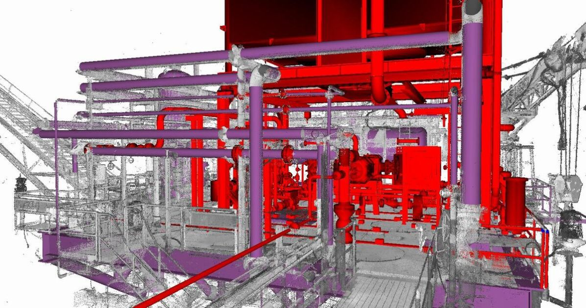
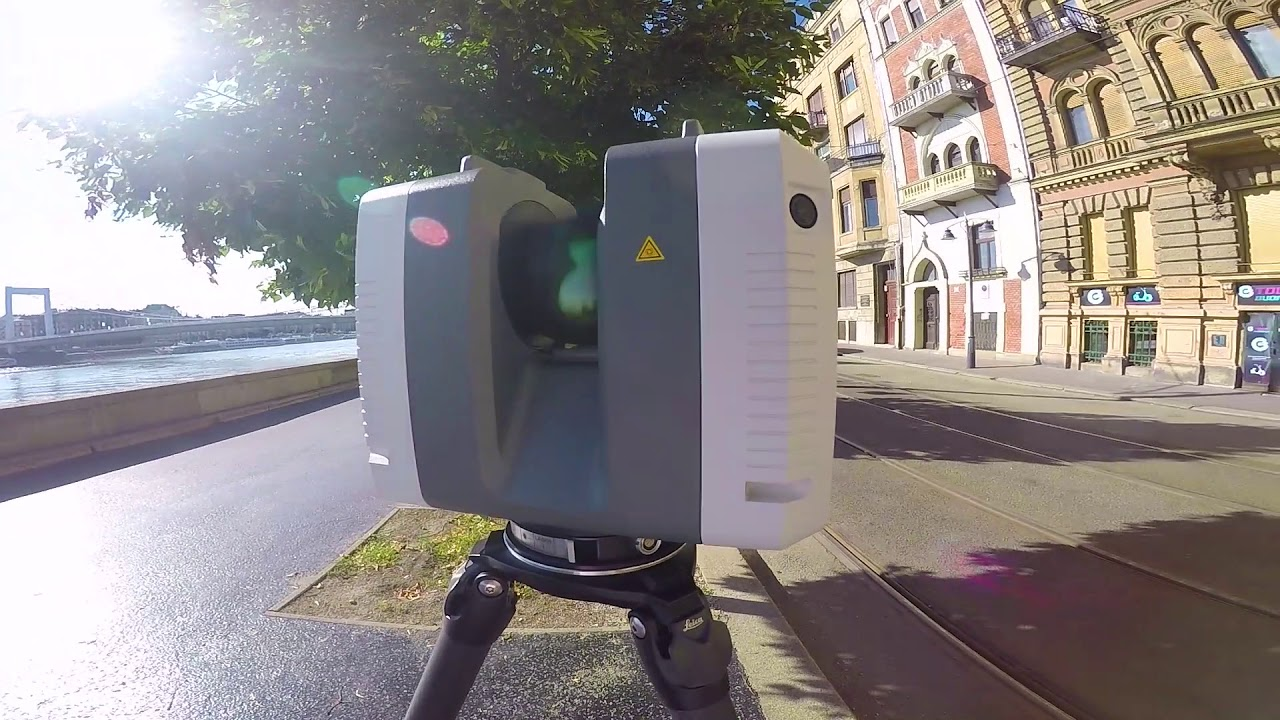
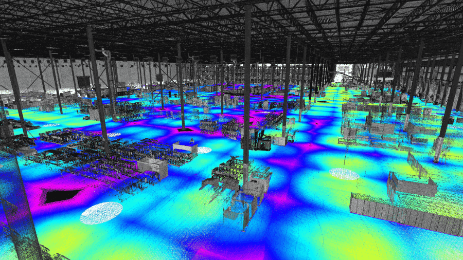
3D laser scanning is transforming how industries capture reality. By using advanced LiDAR and imaging technologies, we can create highly accurate digital models of environments, structures, and assets. These scans eliminate guesswork, reduce costly errors, and provide a permanent digital record.
Unlike traditional survey methods, laser scanning gives you speed, precision, and confidence. Whether you need to document a crime scene, measure a bridge, or validate square footage, scanning provides the truth you can measure and build from.
Nationwide Reach
Our teams are mobile and fully equipped to handle projects anywhere in the continental United States. Whether you're on the East Coast, Midwest, or West Coast, we can mobilize quickly to meet your timeline and requirements.
What Laser Scanning Can Do Across Industries
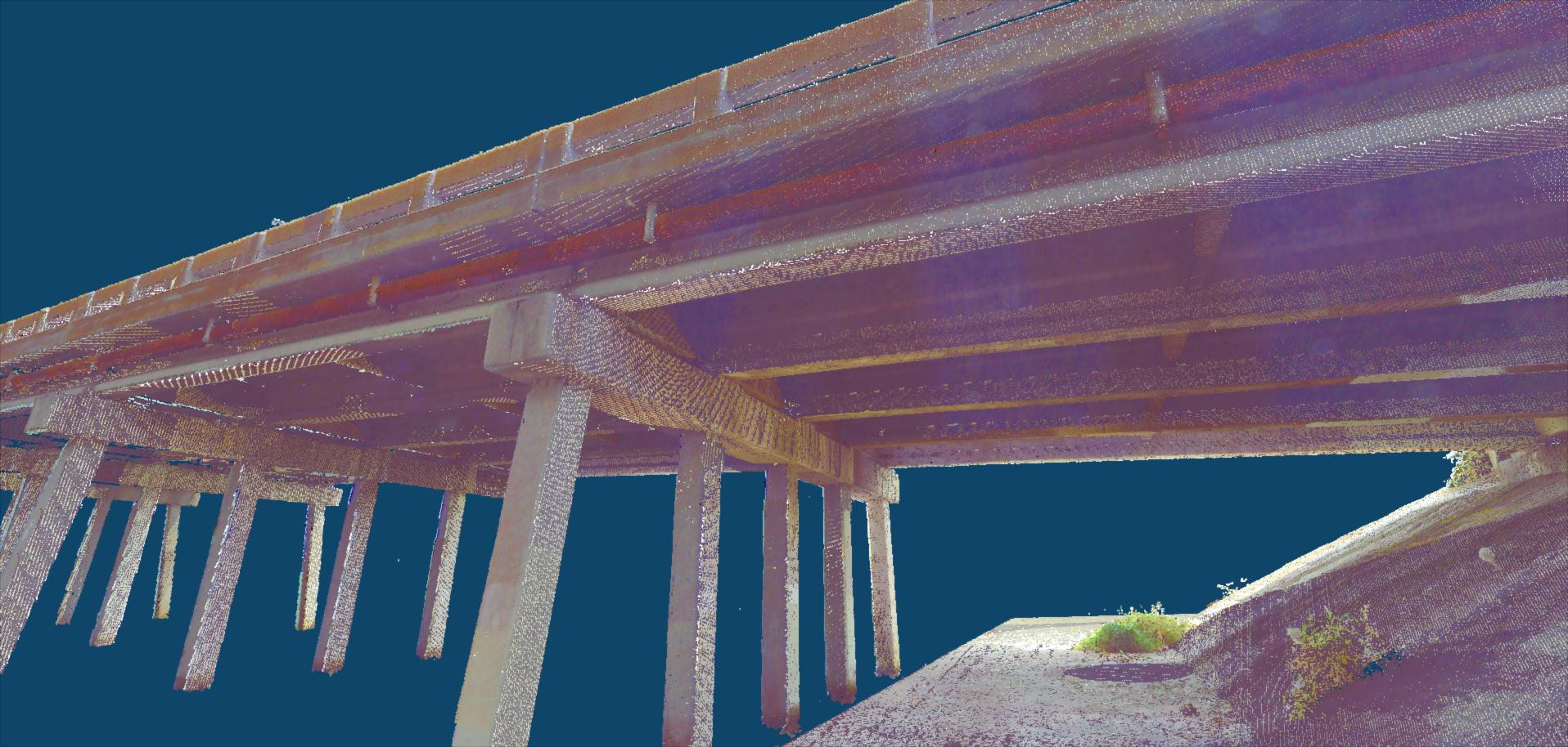
🏗 Civil Infrastructure
- Roadways & Bridges – Measure deformation, settlement, or damage.
- Rail & Transit – Scan tunnels, stations, and tracks for clearance and safety.
- Airports & Ports – Map large-scale infrastructure for planning and upgrades.
- Utility Mapping – Locate and document underground or overhead utilities.
🚔 Public Safety & Forensics
- Crime Scene Reconstruction – Capture accurate 3D evidence for court use.
- Accident Investigation – Document crash scenes with millimeter accuracy.
- Disaster Response – Assess damaged structures or hazardous zones quickly.
🌱 Energy & Utilities
- Renewables – Optimize wind farm layouts or solar installations.
- Transmission Lines – Analyze sag, clearance, and encroachment risks.
🏡 Real Estate & Facilities
- Virtual Tours – 3D scans for marketing properties.
- Space Management – Optimize layouts for corporate or retail spaces.
- Lease Validation – Verify square footage for rental agreements.
- Facility Maintenance – Integrate scans into CMMS software.
🌍 Geospatial & Environmental
- Topographic Surveys – Generate high-accuracy terrain models.
- Mining & Aggregates – Volume calculations for stockpiles and pits.
- Coastal & Flood Modeling – Track erosion, sea level rise, or levee integrity.
- Forestry – Measure canopy density and biomass.
Featured Service
Concrete Pour Flatness & Levelness Scanning
Need to verify slab quality? Our concrete pour flatness scanning service offers full-surface 3D scans, producing precise FF/FL results and easy-to-share reports. Ideal for construction teams who want confidence before moving to the next phase.
Explore Concrete Pour Flatness Scanning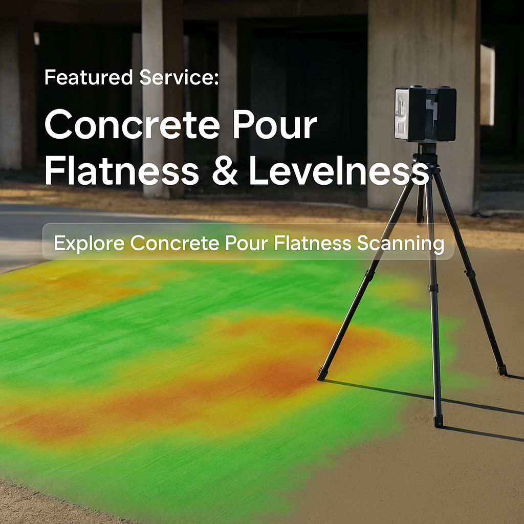
Why Work With Us?
Nationwide Coverage
Teams ready to deploy anywhere in the continental U.S.

Experienced Professionals
Experts in civil, forensic, environmental, and industrial scanning.
Trusted Accuracy
Delivering scans that integrate directly into BIM, CAD, and GIS workflows.
Laser scanning is no longer just a niche tool — it's the backbone of digital twins, BIM, and smart infrastructure. From construction sites to heritage sites, from crime scenes to power plants, scanning provides one thing every sector needs: truth you can measure and build from.
Ready to bring 3D scanning to your project?
📩 Get in touch with our team and we'll provide a custom proposal for your needs.